This blog will be written in both Swedish and English going forward.
🇬🇧
When we think of archaeology, we often imagine dramatic discoveries: silver hoards, picture stones, skeletons with jewelry or weapons. But one of the most powerful tools in modern archaeology is invisible to the eye… the chemical traces left in the soil.
At the Viking Age harbor of Fröjel on Gotland, archaeologists in the 1980s and 1990s used phosphate analysis to unlock the hidden story of the landscape. Phosphates are chemical compounds that come from organic activity: food waste, animal poop, burning, even human remains. Over centuries, these elements seep into the soil and remain there, long after wood, textiles, and even bones have disappeared.
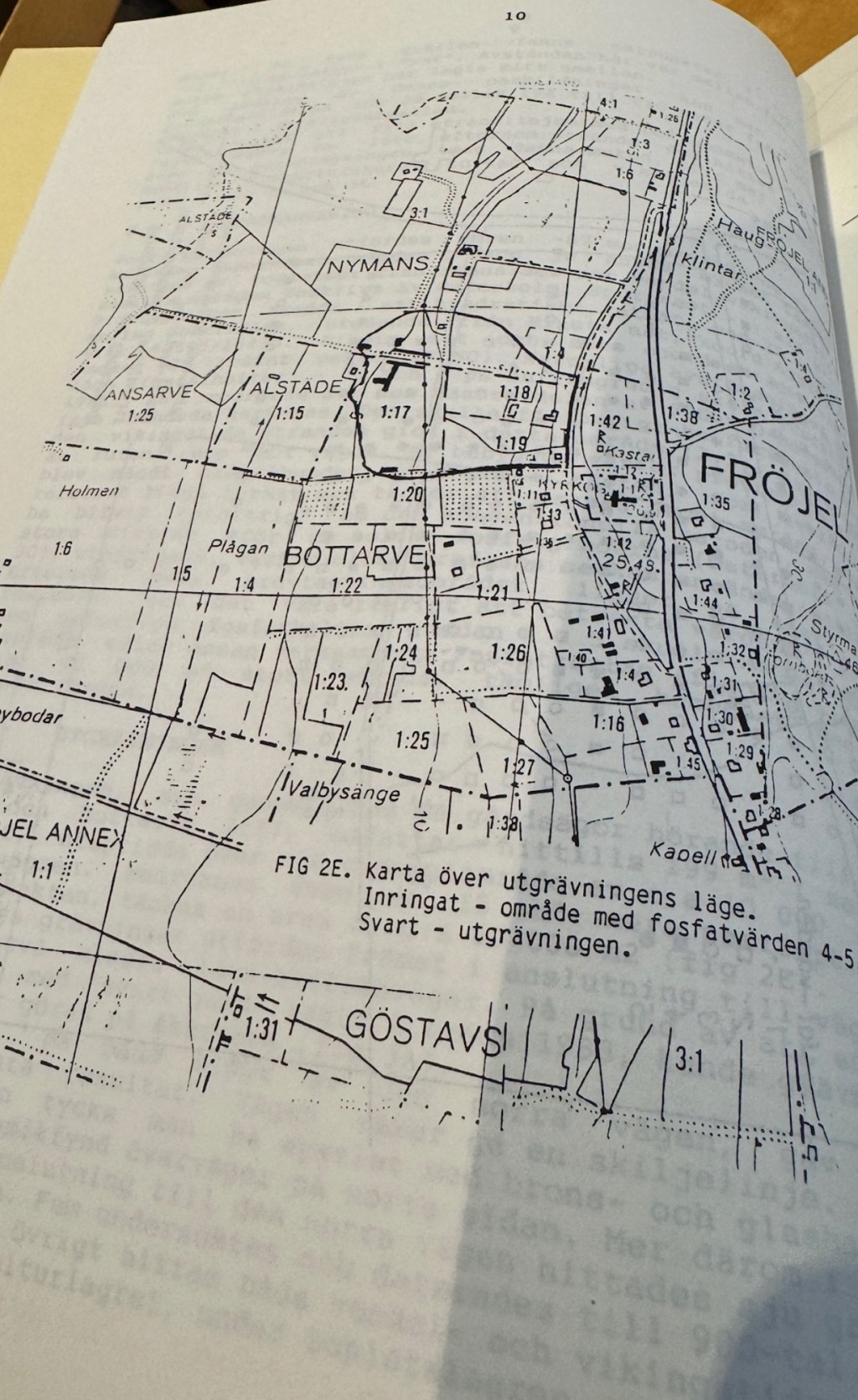
By systematically testing the soil, archaeologists created phosphate maps: diagrams where darker or higher values reveal hotspots of past human life. In Fröjel, these maps showed clusters of activity that matched up with settlement areas, workshops, and cemeteries. In other words, they told the story of where people once lived, worked, cooked, buried their dead, and threw away their rubbish.
The beauty of phosphate mapping is that it provides a blueprint before excavation begins. Instead of digging blindly, archaeologists could focus on areas where soil chemistry whispered of heavy use. This made excavations more efficient, but also more meaningful, because they could compare the chemistry with the artifacts later uncovered.
In Fröjel, the phosphate evidence confirmed what the harbor location suggested: this was not a quiet farmstead, but a thriving settlement, busy with people and animals, filled with workshops, graves, and trade goods. The invisible chemistry of the soil became the first proof that Fröjel was once a beating heart of Viking Gotland.
Phosphate maps may lack the glamour of a silver hoard, but without them, the story of Fröjel would be far harder to tell. They remind us that archaeology is not only about treasures ; it is about science, patience, and the traces left by ordinary life.
🇸🇪
När man tänker på arkeologi tänker man ofta på stora fynd: silverskatter, bildstenar, skelett med smycken eller vapen. Men en av de viktigaste metoderna är jordens kemi.
I vikingahamnen Fröjel på Gotland använde arkeologer på 1980- och 1990-talet fosfatanalys. Fosfat kommer från mat, avfall, djur, eld och till och med människor. Dessa ämnen stannar kvar i jorden i hundratals år, även när trä och tyg är borta.
Genom att mäta fosfat i marken gjorde arkeologer fosfatkartor. På kartorna syns områden med mycket aktivitet. I Fröjel visade dessa områden var folk hade bott, arbetat, lagat mat, begravt sina döda och slängt sitt skräp.
Det fina med fosfatkartor är att man kan se innan man gräver var det är bäst att börja. Det gör grävningen snabbare och ger bättre resultat.
I Fröjel visade kartorna att platsen var en stor boplats med människor, djur, verkstäder, gravar och handel. Fosfaten i jorden blev det första beviset på att Fröjel var ett centrum i vikingatidens Gotland.
Fosfat är kanske inte lika spännande som en silverskatt, men utan fosfatkartorna skulle vi veta mycket mindre om Fröjel. De visar att arkeologi inte bara handlar om skatter, utan också om vetenskap, tålamod och spåren av vardagsliv.
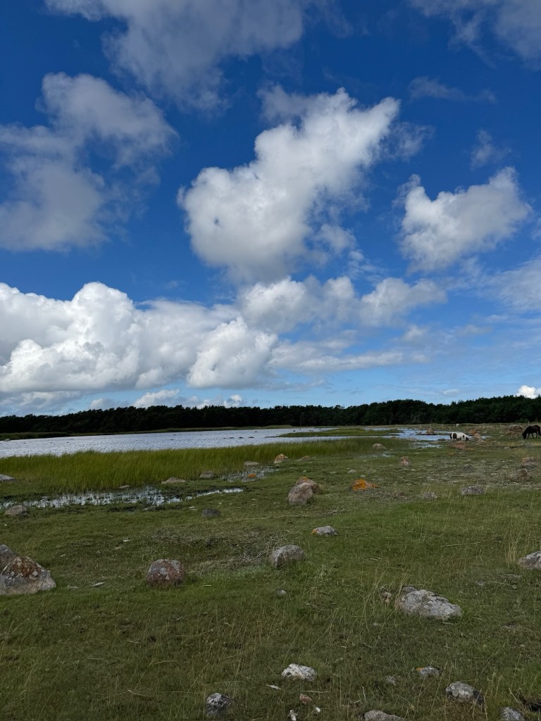
The harbor at Fröjel today. Soil chemistry revealed that this quiet landscape once bustled with trade and life.

Phosphate map from Fröjel. Darker areas show where people lived, worked, and left traces a thousand years ago.
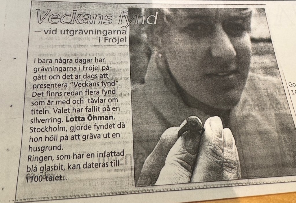
News about the Fröjel excavations in the 1990s. Archaeologists combined soil chemistry with traditional digging to tell the story of the site.
Nyheter om utgrävningarna i Fröjel på 1990-talet. Arkeologerna använde både jordkemi och traditionell grävning för att förstå platsen.


You must be logged in to post a comment.